
King tides return to Coronado the mornings of Dec. 4 through Dec. 6. These extreme high tide events, which are caused by the gravitational forces of the moon and sun, give a glimpse of the future as sea levels rise.
The National Oceanic and Atmospheric Administration (NOAA) describes king tides as naturally occurring, predictable high tides that are one to two feet higher than average. NOAA reports the historical mean high tide for the closest tidal station in San Diego is 4.56 feet. The upcoming king tides are forecasted up to 7.09 feet.
The sea level in San Diego has been rising by 2.2 millimeters (around 1/10 of an inch) per year, but the rate is increasing due to warmer ocean temperatures and melting ice caps caused by climate change. As the average water levels rise, so do the high tides. Today’s king tides will one day become the average high tide.
The City of Coronado’s 2021 Community Satisfaction Survey showed 68% of respondents were at least somewhat concerned about sea-level rise in Coronado. The greatest sea-level-rise threats are storms, Santa Ana winds, and king tides that amplify high water levels, damaging property and infrastructure.
The City’s 2022 Sea Level Rise Plan identifies vulnerable locations when the sea level rises between 0.8 feet and 4.9 feet, which could occur as soon as 2030. The wide beach and seawall have long protected against moderate sea-level rise in most of the western areas of Coronado. But our beaches are becoming more vulnerable. According to Dr. Reinhard Flick, an oceanographer at Scripps Institution of Oceanography, Stan’s Beach by the Coronado Shores has lost more than 200 feet of sand since the winter of 2022-2023. The beach width near the foot of Loma Avenue has slowly decreased by approximately 50 feet in the last 15 years.
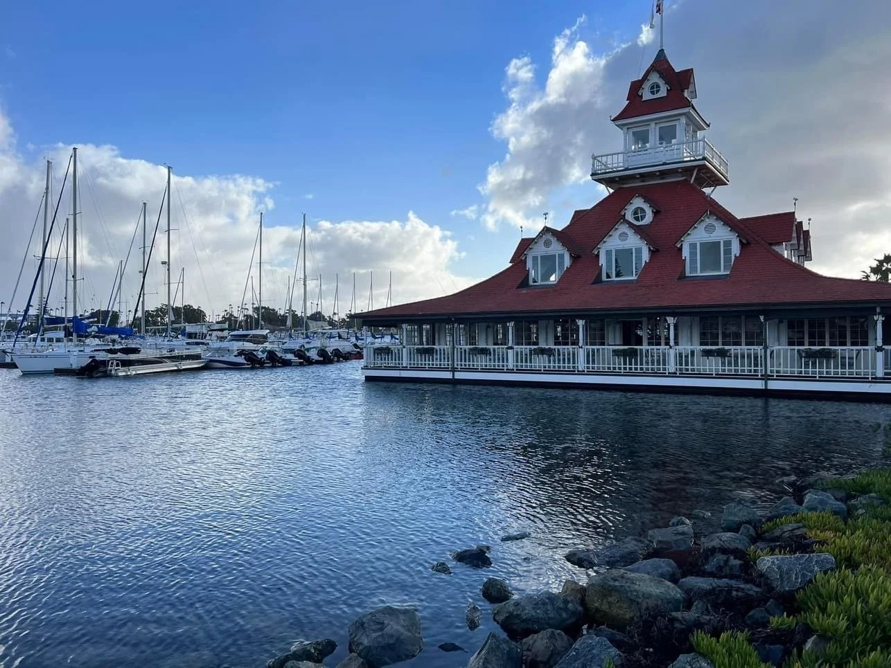
Several bayside locations have been deemed vulnerable to storm flooding even at low levels (0.8ft) of rising waters. These include:
• Coronado Yacht Club and Bluewater Boathouse restaurant
• Coronado Cays
• Alameda Avenue at First Street
• Ferry Landing area
The City’s Sea Level Rise Adaptation Plan estimates the cost to Coronado from inaction ranges from approximately $15 million to $2.1 billion. The plan outlines near-term priorities and long-term strategies to mitigate damage, including engineering projects, nature-based solutions, and managed retreat, which relinquishes land back to the natural environment.
The California Coastal Commission is asking residents up and down the state’s coastline to send in photos during the highest tides for the California King Tides Project. The project’s goal is to assemble a record of the changes to our coast and estuaries to help visualize the impact of rising seas in the future.
For information on how to participate and where to upload images, go to coastal.ca.gov/kingtides. Looking for tips on how to participate? The Commission is offering a free webinar from noon to 12:30 p.m. on Dec. 2, which includes photography tips.